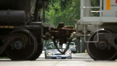
US Railway crossing accidents are up sharply over last year, but the Federal Railway Administration (FRA) is about to get some high-tech help. Google's Maps will soon include the locations of every public and private highway rail crossing location in the nation. The app will also give drivers navigating with Maps audio and visual alerts when they approach those spots. The FRA said that 270 people were killed in rail crossing accidents in 2015, 48 more than last year. They speculated that, ironically, the increase may be partly due to inattention caused by increased smartphone use on roads.
That said, the FRA also told the New York Times that "there are many cases where drivers lack situational awareness, because it may be dark or the route is unfamiliar," particularly at uncontrolled crossings. In those cases, Google's app could snap drivers back to attention, provided they were using it to navigate. If not, the administration has also asked Apple, MapQuest, TomTom and Garmin to include similar features. In the meantime, it also has its own app.
Engadget


Comments
Post a Comment